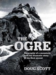
The Ogre, page 14


In 1994 I was made a CBE and in 1999 awarded the Patron’s Medal of the Royal Geographical Society. I was most proud to be president of the Alpine Club from 1999 to 2001 and it was a great honour to receive the Lifetime Achievement Award from the Piolets d’Or in 2011 following on from Walter Bonatti and Reinhold Messner.
– More books by Doug Scott –
Big Wall Climbing (1974)
The Shishapangma Expedition (1984)
Himalayan Climber (1992)
Up and About (2015)
For more information about
Community Action Nepal, see:
www.canepal.org.uk
– Photographs and Maps –
The Ogre. Photo: Ronnie Richards.
The Ogre, the highest and most difficult peak in the area of the Biafo Glacier. Photo: Galen Rowell, 1975.
Surtsey, the southernmost part of Iceland, is the furthest isle in this photograph. It erupted to the surface in 1963 and by 1967 reached its present size. It is an example of the submarine volcanic action coming up through the fissure of the sea floor known as the Mid-Atlantic Ridge.
Great Trango Tower: first climbed in 1977 by Americans Dennis Hennek, Jim Morrissey, John Roskelley, Galen Rowell and Kim Schmitz.
The Nameless Tower. First climbed in 1976 by Martin Boysen and Mo Anthoine, and by Joe Brown and Malcolm Howells the following day.
Excellent granite for rock climbing on Lobsang Spire. Photo: Greg Child.
On the Karakoram Highway with the huge North Face of Rakaposhi dominating the Hunza valley.
Ulugh Beg (1394 –1449), one of Islam’s greatest astronomers and mathematicians during the Middle Ages. He was the grandson of the great warrior Tamerlane.
Ulugh Beg’s observatory, Samarkand. His work in trigonometry and spherical geometry contributed indirectly to the Great Trigonometrical Survey of India.
The Registan is at the heart of the ancient city of Samarkand, now in Uzbekistan. It was one of the most important places on the Silk Road.
The Satpara Buddha: the Buddha was carved into the granite and it is estimated it was made in the seventh century. It is to be found halfway between Skardu and Satpara.
Crossing the Indus upstream from Skardu.
Nanga Parbat: this magnificent mountain delineates the western end of the Himalayan range.
The Deosai Plateau: crossing the Parishing river in 1985.
Godfrey Thomas Vigne (1801–1863).
Looking north to the Indus and Shigar valleys from the northern edge of the Deosai Plateau.
Captain Thomas George Montgomerie, R.E.
K2 viewed from the flanks of Broad Peak.
Henry Haversham Godwin-Austen.
Concordia as seen from K2, with Bride Peak (later renamed Chogolisa) on the left.
Sir Francis Younghusband.
Wali leading the way over the Mustagh Pass, hacking at the ice with a pickaxe bought in Yarkand.
Martin Conway (1856–1937). Reproduced by kind permission of the Alpine Club Photo Library, London.
View to the east from the top of Hispar Pass with the Ogre seen by Europeans and drawn for the first time.
This watercolour appears in Conway’s book labelled as ‘The Ogre from Ogre Camp’. It is so obviously not the Ogre he referred to looking east from the Hispar Pass. It may always remain a mystery as to why Conway caused this confusion to arise. Amongst climbers the peak as illustrated is now referred to as Conway’s Ogre and appears on the Shipton map as Uzun Brakk.
The magnificent north side of the Ogre, first seen by Martin Conway and his team from the Hispar Pass in 1892. This photograph was taken by Nobuo Kuwahara from a camp on South Tahu Ratum Glacier in 1975.
I am grateful to Salman Rashid for making this map available from his book, The Apricot Road to Yarkand. The legend with the map indicates ‘Mapped on the basis of the Surveys made by British and Russian Officers up to 1875. Compiled under the orders of Colonel J.C. Walker … Superintendent Great Trigonometrical Survey of India … Dehra Doon, June 1875.’ Point 23,914 is the Ogre. The Biafo Glacier is to the west of the Ogre.
Fanny Bullock Workman and Dr William Hunter Workman.
Eric Shipton and Bill Tilman. Reproduced by kind permission of the Alpine Club Photo Library, London.
The 1971 Yorkshire Karakoram expedition. L–R: Don Morrison, John Gregory, Trevor Wright, Dr Hidyar Ullah and Dave Marshall. Photo: Clive Rowland.
British regimental insignia on the cliff face in the Khyber Pass.
The Ogre (right) and Ogre II from Choktoi Glacier.
The Ogre from Ho Bluk on the opposite (south side) of the Biafo Glacier. The ridge on the left skyline is the West Ridge above the West Col.
The south side of the Ogre and Ogre II.
The Ogre: summit detail.
Clive Rowland.
Mo weighing in the loads with our liaison officer Aleem.
Paul ‘Tut’ Braithwaite.
Chris jumaring up our climbing rope en route to the final tower.
Nick Estcourt.
Polo tournament at Skardu. Photo: Nick Estcourt.
Dusso: the start of the trek until a new Jeep road was pushed up the valley to Askole by 1990.
Registering porters at Dusso.
A Karakoram oasis – wherever there is flat ground and water there is life, otherwise the Karakoram is all mountain desert.
The porters earn every rupee they are paid for such heavy and dangerous work.
The hot geothermal sulphur springs thirty minutes’ walk from Chongo and our last bath for many weeks.
Stately poplars.
Haji Mehdi, the headman of Askole, who became over the years a good friend.
Only in the remote areas and in the Hunza valley are women to be seen in this land of Islam.
All of the Balti we came across were strong characters.
There is evidence of inbreeding and also of iodine deficiency resulting in quite large goiters that restrict movement of the head.
Life is hard at Askole, 10,000 feet above sea level, where temperatures remain subzero for up to four months of the year; consequently life expectancy is relatively low.
Leaving the ablation valley to cross the Biafo Glacier.
Porters resting at the entrance to the Baintha Lukpar and Uzun Brakk glaciers and our first close view of the Ogre in 1977 – to the left is the Ogre’s Thumb and to the right, in cloud, Ogre II.
The Ogre with the entrance to the Uzun Brakk Glacier.
Base Camp. The triangle of green pasture with a clear freshwater stream running across it made an excellent site for Base Camp, being protected from the valley winds by the two coalescing lateral moraines.
The Ogre south side. Advanced Base Camp was placed on the wide expanse of snow, convenient for the prominent South Pillar and the South-West Spur on the left.
The Ogre from the air, showing the Uzun Brakk Glacier curling up from the left, around the Ogre’s Thumb and up to the South-West Spur leading to the West Col on the left side of the Ogre. The upper half of the South Pillar can be clearly seen in this photograph, as can the final summit tower. Photo: Galen Rowell.
Making plans at Base Camp. L–R: Tut and I intend to climb the South Pillar; Nick with Chris, and Clive with Mo, are planning to climb up to the West Col together.
Advanced Base Camp. From here the expedition divided; Tut and I headed to the rock pillar.
The team at Advanced Base Camp. L–R: Clive Rowland, Chris Bonington, Nick Estcourt, Doug Scott, Tut Braithwaite and Mo Anthoine.
The 3,000-foot South Pillar of the Ogre.
Climbing the loose gully to the start of the pillar. Further up I dislodged a rock that smashed into Tut Braithwaite’s thigh, very sadly putting him out of action for the rest of the trip. Photo: Tut Braithwaite.
Tut Braithwaite struggling back to Advanced Base Camp after the accident.
Steph Rowland (left) and Jackie Anthoine – the two wives arrived at Base Camp ten days after their husbands, Clive and Mo, and the rest of the team. For a few days they humped loads up to Advanced Base Camp before leaving as their permits were not in order.
Memorial cairn to Don Morrison. Don fell to his death down a crevasse on the Baintha Lukpar Glacier during the Yorkshire Expedition’s attempt to climb Latok II.
Granite slabs at the start of the South-West Spur. Conway’s Ogre is on the left.
Looking down the South-West Spur.
The Ogre: the South-West Spur can be seen on the left leading up to the West Col. Halfway up is Camp I. From the West Col Chris and Nick traversed the cummerbund of snow to the right-hand end from where they gained access to the South Face snowfields. Photo: Ronnie Richards.
The route taken by Chris and Nick for the Main Summit and West Summit.
Chris leaving the snowfield cutting across the South Face. Photo: Nick Estcourt.
Nick climbing up granite slabs covered in ice and thin layers of snow. Photo: Chris Bonington.
View of the summit tower from the West Summit. Photo: Chris Bonington.
Camp I – Mo, Clive and Tut having a brew at this exposed campsite but safe from rockfall.
Nick melting snow for a brew just below the West Summit. Photo: Chris Bonington.
Kanjut Sar (25,460 feet/7,760 metres) from the West Col snow plateau.
Starting to climb the Red Pillar.
Camp III – Conway’s Ogre (21,070 feet/6,422 metres) is seen on the near right. Sosbun Brakk, (21,040 feet/6,413 metres) is on the far right. The two rounded summits left of centre are Ganchen and Hikmul.
Camp III with Snow Lake and the Hispar Pass in the distance.
‘Man of the Mountains’ Clive Rowland at the top of the Red Pillar.
On the Red Pillar of the West Ridge with the Sim Gang Glacier, Snow Lake and the Hispar Pass in the middle distance.
The West Ridge beyond the Red Pillar. To the right is a 5,000-foot sheer drop to the Sim Gang Glacier.
West Ridge bivouac. This was the penultimate bivouac before the summit, where we were full of optimism and enjoyed a fine evening supping tea while watching the sun go down.
Clive and Mo leading the way across steep snow towards the West Summit.
Mo and Clive enjoying a well-earned brew stop.
Checking out the Main Summit from the West Summit. Photo: Chris Bonington.
Chris stirring the porridge in our highest snow cave. Mo and Clive are tucked away in the back.
The final tower of the Ogre.
Chris heading toward the final tower.
The route from Camp III to the summit.
Racking gear for the crux pitches of the climb. Photo: Chris Bonington.
Negotiating a hairline crack on the steep headwall, with the aid of pegs. Photo: Chris Bonington.
The wall relented and the cracks were wide enough for free climbing. Photo: Chris Bonington.
At 100 feet the crack ended in blank rock. I fixed a wire chock and asked Chris to lower me down fifty feet so that I could make a pendulum swing to reach a crack system on the right. On the fifth attempt I managed to enter a crack and climb it to a belay. Photo: Chris Bonington.
Chris taking out the equipment on the crux pitch of the climb. The weather was calm and sunny and the rock dry, rough granite – the best of conditions for such a pitch. Below is the basin up which Nick and Chris had climbed to make the first ascent of the West Summit.
On the summit of the Ogre at 7 p.m. anxious to descend to our sleeping bags at the cave bivouac. Photo: Chris Bonington.
Chris on the summit of the Ogre.
Diagram showing our route up the summit tower and the scene of the accident.
Looking across to the West Summit: Mo and Clive are on the West Ridge, from where they retreated intending to make their ascent to the summit the following day. The line of tracks in the snow lead to the snow cave. Photo: Chris Bonington.
Chris digging out the entrance to the snow cave which had become blocked in the storm.
Clive and Mo took charge of getting me up to the West Summit and down via the rocky West Ridge, to the West Col and 4,000 feet down the South-West Spur.
Crawling down from the West Summit towards the top of the Red Pillar. Clive can be seen in the picture, Mo had gone ahead fixing abseils. Chris kept me on a tight rope while taking this photograph. Photo: Chris Bonington.
Very soon the storm intensified, making the descent more difficult. Photo: Chris Bonington.
Starting to descend the Red Pillar. Photo: Chris Bonington.
On the Red Pillar, where Chris later smashed his ribs. Photo: Chris Bonington.
Looking down the Red Pillar towards Camp III barely visible on the snow.
Clive in the tent suffering from frostbitten fingers and toes.
Playing cards with Mo while listening to Dr Hook on the tape deck. Photo: Clive Rowland.
Down on the West Col snow plateau, with me carrying a sack for the first time, crawling past Mo who adds climbing gear to my load Photo: Clive Rowland.
I found it most difficult when having to traverse across steep rock. Photo: Clive Rowland.
After eight fraught days on the Ogre, now safe crawling down the upper Uzun Brakk Glacier towards Base Camp. Photo: Clive Rowland.
Back at Base Camp: Clive is trying to ease the pain that Chris is suffering from badly smashed ribs.
Chris sitting it out, battered but not broken, playing the waiting game for a total of five days until Nick arrived with our porters.
On the green, green grass that had been our home during the five-day wait for porters. At this point we had faced the possibility that Mo, who had run off down for help, had himself come to grief. We decided to leave and try and make our own way back. Within an hour of starting out Nick and the porters arrived. Photo: Chris Bonington.
The Biafo Glacier. The edge of the green pasture of Base Camp can be seen just left of the Ogre’s Thumb. The porters carried me with difficulty down the Uzun Brakk Glacier to where it meets the Baintha Lukpar, and then more easily down the Biafo to Askole over three days.
Showing Nick the wounds; with Nick’s arrival Chris and I were able to take our first painkilling tablets. We had not packed a first aid kit for the climb. I had worn through four pairs of overtrousers down to my knees, which were more painful than the broken legs at the time. Photo: Nick Estcourt.
I could not help speculate that the Balti porters probably thought we were all mad, rushing into their mountains with quite a few of us dying there or being carried or helicoptered out with severe injuries. Photo: Clive Rowland.