About Time, page 11


The first regular time signal at Cape Town was a cannon fired daily at noon from a battery on the castle, which had been built in the seventeenth century on the Table Bay waterfront. The castle had allowed Dutch settlers to protect their new colony, but in 1806, when the Cape was seized by British forces, the incoming military engineers installed their latest and most powerful guns there. The noonday firing, which began the same year, was an expression of military power as much as it was a practical navigational signal, although it would be easy to argue that the two purposes amounted to the same thing. However, the time which the gun signaled each day was not, to begin with, accurate enough.
The Cape was formally handed over by the Dutch to the British in 1814 but it took until 1820, as Britain’s empire grew, for the idea of a permanent astronomical observatory and time signal station overlooking Table Bay to come to its Board of Longitude, so that navigators could get a better time fix for their chronometers before setting sail. The site chosen for the new Royal Observatory, on high land to the northeast of Table Mountain with a commanding view of the Bay, missed the worst of the clouds and sand dust that covered sites elsewhere in the colony, but it was a challenging place for the newly appointed astronomer, Fearon Fallows, who had grown up in the relative comfort of Cumbria and Cambridge. “In the days of Fallows,” wrote a later Cape astronomer, “this site was part of a bare, rocky hill, covered with thistles, infested with snakes . . . the jackals howled dismally around it at night, and a guard of soldiers had to be established to protect the property from theft.”4 It was also a burial ground for enslaved people and the wind could sometimes be so strong as to knock riders from their horses.
It took a few years for the permanent observatory buildings to be completed, but even while he was working out of a temporary hut in the garden of a rented cottage in town, Fallows started providing time signals for the ships in Table Bay. From 1821 he sent his assistant, James Fayrer, with the correct time to the docks so that captains could check their chronometers against Fayrer’s corrected watch. Two years later, Fallows began shining a bright oil lamp toward the water each evening before shuttering it at a fixed time. Fallows died in 1831, replaced by Thomas Henderson, who set up the time ball service down in the bay two years later, triggered by his pistol flash from the new observatory roof. When he quit the observatory soon after starting the time-pistol service, he promised to tell friends back in Britain “all about my residence in Dismal Swamp among Slaves and Savages.”5
From the moment Fearon Fallows had arrived at the Cape, he had built the newly founded observatory on slavery. In 1822, he boasted to his British government supervisors of an “experiment” in which he would apply for and train a series of enslaved boys in observation techniques so that he would eventually build up a workforce of astronomical assistants that “would always be under absolute command.”6 In 1825, as building work on the observatory began, the contractor advertised for “sixty good Masons, and as many Labourers, to work at the Royal Observatory; likewise, thirty strong Slave Boys by the month.”7 Fallows also employed formerly enslaved people at the observatory as servants, but preferred direct slave ownership where possible. In 1831, Thomas Henderson commented that “Of course a certain number of servants is indispensable—but after the experience which has been already had, great trouble and vexation will be saved by purchasing Slaves at once.”8 Fallows had originally forced his enslaved workers to sleep underground in cellars, before reluctantly converting an instrument storeroom into sleeping accommodations.
Slavery was abolished in 1834 but the astronomers’ exploitation of indigenous Khoikhoi people as servants continued. An observatory assistant, Charles Piazzi Smyth, who arrived at the Cape in 1835, claimed in later life that “the badness, dearness and scarcity of native servants out there, is one of the chief troubles of Cape life.”9 The book in which Smyth recorded punishments given to local workers was literally termed his “Black list.”10
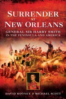
Cape observatory with time ball on mast, engraved in 1857
In 1836, Henderson’s successor, Thomas Maclear, set up a time ball in the grounds of the observatory itself to replace the pistol signal. Later, in the 1850s, a new time ball at the Cape Town docks gave sailors tied up in Table Bay a better view, and time-disc signals were set up at Simon’s Town, on the peninsula overlooking False Bay, and at Port Elizabeth and East London in the Eastern Cape. From 1861, all the balls and discs were operated by an electrical signal from the observatory, as was the old time gun on the Cape Town castle. The electrical signal came from a battery in a wooden hut at the observatory. East London was 600 miles from Cape Town. In 1893, a time ball was set up at Port Alfred, halfway between Port Elizabeth and East London, and an electrically controlled clock was set up in the Harbour Tower at the Cape Town docks giving observatory time to the second. The following year, a new time ball was erected on the waterfront nearby, which is still there. All this infrastructure was built just in order to distribute accurate time from the observatory to the chronometers on board each of the ships in the bay. Time on the southern African coast must have been worth a fortune.
THE EARTH TURNS on its axis once each day, and that is why clocks and trading empires are inseparable. Trade means travel. Overseas travel. Over seas. The problem comes when you can no longer see land. Where are you? Where is the place you need to sail toward? What perils lie between you and your destination? Global seafaring empires based in Europe and built on overseas trade began to grow in the fifteenth century. Portugal started capturing people and land in 1415. Spain followed in 1492, then France from about 1534 and the Dutch Empire began to form in about 1543. Britain was late to the party, starting to seize land in 1583 but only really getting going twenty years later. The British politician and colonizer Walter Raleigh, in about 1615, said that “whosoever commands the sea commands the trade; whosoever commands the trade of the world commands the riches of the world, and consequently the world itself.”11
Sailors became remarkably adept at navigating on long ocean voyages. Measuring the height of the Sun or stars could give them their latitude, or north–south position. A compass could give them their direction using the magnetism of the Earth. Log-lines—ropes with evenly spaced knots paid out over the side of the ship—could give a good estimate of speed when used with an hourglass. The saltiness of the water; the presence of different types of flora and fauna; the direction of currents and winds; the depth of water near coastlines; and meticulous record keeping on good sea charts all helped solve the problem. But there was a big one that remained, which was a reliable method to find longitude, or the ship’s east–west position. Without it, crews risked crashing into rocks or, just as fatal, running out of supplies when land was further away than they thought. Often, it just meant inefficient voyages in which sailors traveled more slowly than necessary or took long diversions to ensure safe arrival.
The “flying Dutchman,” a legendary tale from the eighteenth century, told of a ghost ship that haunted the Cape of Good Hope in bad weather, unable to make the harbor and doomed to roam the seas for eternity. Its origins came from seventeenth-century Dutch East India Company ships sailing around Africa on their way to India and Southeast Asia.
A typical voyage involved sailing from Europe straight down the middle of the Atlantic Ocean until the navigator’s instruments indicated the ship had reached 34 degrees south, the latitude of the Cape, before turning east and hoping that a few days’ further sailing would bring land into sight. That is how the first Dutch settlers reached the Cape in 1652. But often enough ships would miss their target and overshoot, having to sail north until meeting the southeastern coast of Africa before turning back, slowly hugging the coastline until Table Bay came into view. On particularly ill-fated voyages, the ship might bounce around, back and forth, trying to reach a haven in furious weather, losing time, food and fresh water as it did so. As disease and thirst took more and more sailors, eventually the crew could lose control of the ship and it would become lost, carrying only the corpses of those last to die. Another flying Dutchman would haunt the oceans around Africa.
But as European maritime empires grew ever larger and more ambitious, there was no time to beat about as there was money to be made. Loss of life at sea was regrettable, but loss of valuable cargoes hit profits, and money was therefore the real motivation (of course) behind solving the problem. The answer to the problem of longitude, as everybody had known by the middle of the sixteenth century, was clocks, because the Earth turns on its axis once each day.
THE LOCAL TIME by the Sun in Cape Town is different from the local time in Mumbai by three hours, thirty-seven minutes. The time difference is exactly equivalent to their longitude difference, where each hour of time is equal to fifteen degrees of longitude. So, Cape Town and Mumbai are 54.5 degrees of longitude apart. All you need to find your longitude position when at sea, relative to a fixed place such as your port of departure, is the local time at that port, and at the place where you now are, at the same instant.
Finding the local time on board a ship in the middle of the ocean was quite straightforward. When the Sun reached its highest point, it was local noon. Devices that measured angles solved this: cross staffs, back staffs, octants, sextants. Finding local time at the port you had just sailed from was the hard part. It seems obvious now that sailors simply needed to carry a clock on board set to port time (let us say Cape Town). In fact, this was known as early as 1530, but at that time there did not exist a clock or watch on Earth that could keep time to the accuracy, precision and stability needed during a months-long ocean voyage, with the violent movement of the ship, the extremes of temperature, and damage caused by the salt- and water-laden air. This was a problem for clockmakers.
But there was a clock above the Earth that could do the job instead, if only its time could be read. As early as 1514, experts started drawing up plans to use the Moon and stars in the sky like the hands of a giant celestial clock. This was called the lunar-distance method, because it used the angular distance of the Moon from certain stars on any given night to tell navigators the time at a fixed place on Earth. The trouble was, the stars had not been mapped systematically enough for this to work, and, anyway, nobody had yet built a portable device to measure the angles accurately enough. This was a problem facing astronomers and instrument makers.
A mechanical timekeeper or the lunar-distance method. Either would give sailors the time at their home port, but neither was yet possible, so the big maritime nations started throwing money at the problem. In 1567, Philip II of Spain put up a cash reward for a practical longitude scheme and his successor, Philip III, fronted another one in 1598. No success. In 1600, the Dutch government founded a longitude reward scheme. There were lots of proposals, but nothing worked. In 1667, the French government set up the Paris Observatory as part of its finance minister’s plans to increase trade and build France’s overseas empire, hoping an astronomical solution to longitude would soon follow. It did not. In 1675, the British government followed suit, establishing the Royal Observatory, Greenwich, to map the stars and solve the longitude problem. Lots of valuable work was carried out but no solution was yet forthcoming.
Time passed, and more and more ships were lost. Two thousand people were killed in 1707 when a fleet was wrecked on the Scilly Isles, off Britain’s southwest coast. It was one of Britain’s worst maritime disasters; more people died that night than were killed on the Titanic. The pressure to solve the problem of maritime navigation once and for all was growing ever stronger and from all quarters—from merchants, from ministers, from captains and from the public, whose families were being decimated by the relentless loss of life at sea.
In March 1714, during her speech at the state opening of Britain’s Parliament, Queen Anne exclaimed that “this Country can Flourish only by Trade; and will be most Formidable, by the right Application of our Naval Force.”12 The following month a group of merchants and sea captains responded to her call with a petition to the government, in which they said that:
nothing can be either at home or abroad, more for the common Benefit of Trade and Navigation, than the Discovery of the Longitude at Sea which has been so long desired in vain, and for want of which so many Ships and Men have been lost.13
The answer, they said, was a reward scheme, and just three months later the government passed an act founding a Board of Longitude that offered £20,000 to anybody who could solve the problem to half a degree. It took half a century for the British prize fund to bear fruit, and then it did so twice. By the late 1750s, John Harrison had completed a mechanical timekeeper (later known as a chronometer) that kept time well enough to win the reward money and coped with the rough conditions at sea. By the same time, a consortium of astronomers and instrument makers had mapped the stars and developed the sextant and nautical almanac that made the lunar-distance method a practical reality.
It took a few decades for these two methods of finding longitude to become commonplace. Lunar distances took a lot of effort every night, while people were naturally wary of trusting their lives to a mechanical timekeeper. Some captains took a lot of convincing that a chronometer was worth the expense, but officers involved with pioneering chronometer voyages from the 1770s onward increasingly extolled their virtues. The first captain to use chronometers extensively was the East India Company’s James Dundas, who commanded an East Indiaman to India in 1779. As the ship went around the Cape of Good Hope, Dundas found that the longitude he had calculated using the chronometer was almost spot on, and he used the devices enthusiastically on future voyages.
Slowly but surely, the supply of chronometers went up, the price came down, and resistance to the new arrival was chipped away as the demand for profit in an expanding world market inexorably rose. By the early years of the nineteenth century, navigation had been transformed, with both chronometers and the lunar-distance method in widespread use and, as Queen Victoria came to the throne in 1837, the race was on for imperial supremacy as maritime nations battled to build the biggest global empires.
THE ROYAL OBSERVATORY in Greenwich was responsible for testing all the British Royal Navy’s chronometers as they came off the production line or passed between ships, and it had 500 machines on test at any one time, all in a room about the size of a small studio flat: “what a wonderful instance of the proof of our maritime power is this apartment!” exclaimed the astronomer Edwin Dunkin in 1862. “On entering, the visitor is startled by a universal buzz, which sounds almost like the hum of a beehive.”14
Royal Observatory, Greenwich, chronometer-testing room, photographed c. 1897
It still retains that magical presence today. When I worked at the observatory as its curator of timekeeping in the 2000s, the former chronometer testing room became my office, a room into which all the Royal Navy chronometers serving the British Empire had been carried for their crucial tests for over a century. What a remarkable century. I could almost hear the echoes of their soft, regular, faithful ticks. I almost forgot what they had enabled.
The observatory was just one of many sites where chronometers flowed in and out like the tides. Chronometer makers themselves received their products back many times during their long lives for servicing and overhaul. For them, accurate time shown on the workshop clock was vital to get their machines beating the perfect seconds on which sailors’ lives and the prosperity of empires depended.
Before electricity brought time signals to street corners from the 1870s onward, the only way chronometer makers could know the time accurately enough for their needs was either to measure it themselves, using a portable time-finding telescope called a transit, which was difficult to do in reality, or to send their shop assistant to their nearest observatory with a pocket watch to ask for the time. Even the best chronometer makers tended to prefer weekly observatory visits over using a transit. But the constant interruptions at the observatories from people with watches asking for the time started to become a nuisance from the 1820s onward as chronometers came into widespread use.
At Greenwich, the problem was addressed by switching things round. From 1836, instead of waiting for the chronometer trade to visit, an observatory assistant, John Belville, started taking a corrected pocket watch round the London makers, charging an annual subscription for a weekly visit with a timekeeper accurate to one tenth of a second. When he died in 1856 his wife, Maria, took over the business, and when she retired in 1892 their daughter, Ruth Belville, continued the weekly visits until 1940, when London was in the depths of the Second World War.
It is likely that similar networks existed in other places around the world where chronometers were made—Liverpool, Paris, Hamburg, Copenhagen—though their stories are yet to be pieced together. But it was one thing to distribute accurate time around big cities. It was quite another to get it to all of the empire’s countless ships tied up in places like Table Bay, far from the imperial capitals, so that the chronometers on board could be set right before the ships set sail. The time signals standing around the coastlines of the world were foot soldiers at the frontiers of empire.
IN 1908, A survey carried out by the British navy listed a total of 200 time signals—usually balls, but sometimes discs, guns or flags—that could be found on coastlines or in ports around the world, and the document reveals the astonishing reach of Europe’s maritime powers. But it also speaks volumes about the shifting sands of global geopolitics.